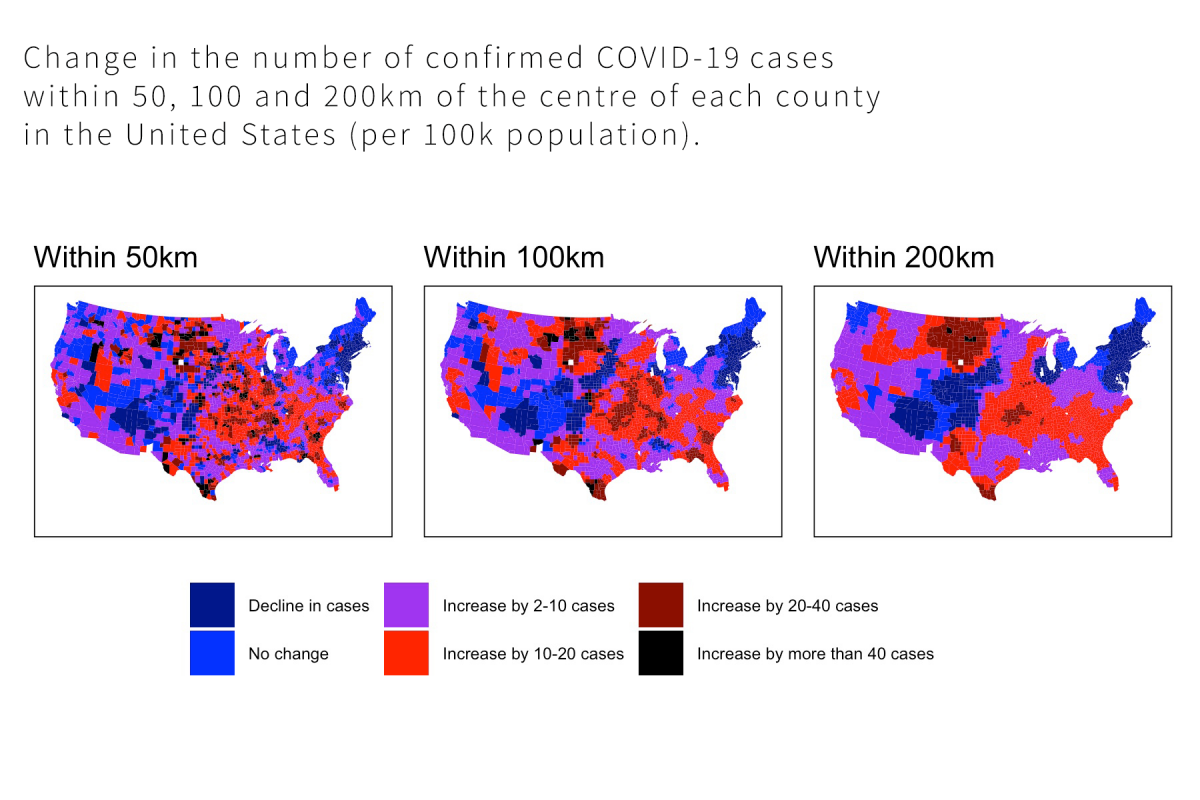
A 2-day course designed for applied users of R who want to take their spatial analysis to a higher level. This master-class will show you how to access spatial data from a number of sources, match this with geographic shape files, analyse spatial patterns, link these data to information from surveys, and create interactive maps to highlight important findings.
This course is being held online via Zoom and run on Australian Eastern Standard Time (GMT +10)
Designed for the applied users of R, this master-class will show you how to access spatial data from a number of sources, match this with geographic shape files, analyse spatial patterns, link these data to information from surveys, and create interactive maps to highlight important findings.
This course will be run over 2 days in three sessions per day:
- 9.30 am - 11.30 am - Session 1
- 12.00 pm - 1.30 pm - Session 2
- 2.30 pm - 4.30 pm - Session 3
This course is being held online via Zoom and run on Australian Eastern Standard Time (GMT +10)

Dr Shaun Ratcliff is a political scientist, survey researcher and applied data scientist.
He is the Principal at Accent Research, where he works with clients on complex social and political research, studying how the public thinks and behaves, what influences their beliefs and actions, and ways to engage with them.
He was previously Director of Data Science at YouGov, and before that, a Lecturer at the US Studies Centre at the University of Sydney where he remains an Honorary Associate and continues to teach data science.
He has a PhD in Political Science from Monash University.
With terabytes of information on consumer behaviour, public transport use, crime statistics and election results sourced from across the world now available almost anywhere in minutes, our ability to answer important questions about the world has never been greater.
Much of human behaviour can be understood (at least in part) as a function of geography. This includes crime, public health and election outcomes. Taught by a quantitative political scientists from the University of Sydney, this masterclass will show you how to access spatial data from a number of sources, match this with geographic shape files, analyse geospatial patterns, link these data to information from surveys, and create interactive maps to highlight important findings.
Designed for the applied users of R who want to take their spatial analysis to a higher level. You will master the use of R and Markdown to clean and manipulate spatial data, produce reports and presentations with high quality visualisations.
This course is for participants who have some experience using R, and is most useful for those who have completed the ACSPRI course Data Analysis in R or equivalent.
Day 1 - Engaging with spatial data
There are some important differences between spatial data and some other kinds of information we usually work with. In particular, we are often operating with data tied to specific spatial coordinates. This includes working with some quite particular data formats, including shapefiles. These are polygons, which store spatial coordinates (latitude and longitude) and other information on spatial units. During the first day of the masterclass, we will look at how these types of spatial data can be accessed, manipulated and analysed. We will look at loading and working with shapefiles, and combining them with other forms of spatial data, including information on geographic units from the Australian Bureau of Statistics. We will finish the day combining what we have learned to explore predictors of the county-level outcomes at the 2020 US presidential election.
Content:
1. Working with shapefiles and other forms of spatial data.
2. Exploring spatial patterns.
3. Problem solving: What predicts spatial distribution of votes in US presidential elections?
Day 2 - Linking survey microdata with spatial data, and visualising our results
On the second day of the course, we will expand on this, linking spatial data with microdata from surveys. This allows us to connect data on individuals with spatial information connected to their location. By doing this, we are able to examine the association between individual attitudes and behaviours and aggregate spatial variables. We will learn how to do this using survey panel data collected in Australia before and after the 2019 bushfires, allowing us to examine how proximity to serious fires is associated with changing attitudes to climate change. Using these data we will also create interactive maps plotting the location of our respondents and major fires. We will then fit some regressions to these data to model spatial trends in attitudes.
Content:
1. Linking survey microdata with spatial information.
2. Creating engaging interactive maps using these data.
3. Bringing it all together: Modelling spatial trends.
You will need your own computer preloaded with R and an internet connection.
We will be in contact prior to the course to ensure you have the software you will need.
Data and course notes will be provided.
This course is designed for applied users of R.
Prior experience with R is necessary.
Completion of the ACSPRI course Data Analysis in R, or equivalent, is helpful.
Course notes will be supplied.
Delivery of this course is online - via Zoom.
Please ensure you have the following:
- Reliable Internet connection with at least 5Gb per day of data available (i.e. a 5 day course will use about 25Gb of data just on the Zoom application)
- A computer/laptop with the Zoom application installed (free)
- A webcam (built in to most laptops)
- A headset with a microphone (not required but ideal)
- A second monitor/screen if possible
Please also check the course page for specific software requirements (if any).
